Atlas
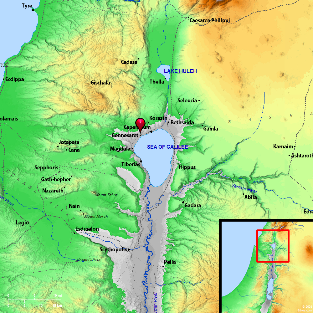
Genneseret and surrounding region
Maps Created using Biblemapper 3.0Additional data from OpenBible.info
You are free to use up to 50 Biblos coprighted maps (small or large) for your website or presentation. Please credit Biblos.com.
Occurrences
Matthew 14:34 When they had crossed over, they came to the land of Gennesaret.
Mark 6:53 When they had crossed over, they came to land at Gennesaret, and moored to the shore.
Luke 5:1 Now it happened, while the multitude pressed on him and heard the word of God, that he was standing by the lake of Gennesaret.
Encyclopedia
GENNESARET, LAND OFge-nes'-a-ret he ge Gennesaret):
1. The Name:
The first syllable of the name Gennesaret is evidently the Hebrew gan, "garden"; while the second may be a proper name. Possibly, however, the name may represent the Hebrew ganne sarim, "princely gardens." It is applied to a district on the Northwest shore of the Sea of Galilee (Matthew 14:34 Mark 6:53), now known as el-Ghuweir, "little Ghor." It curves round from el-Mejdel in the South, to `Ain et-Tineh, or Khan Minyeh, in the North, a distance of over 3 miles, with an average breadth from the sea to the foot of the mountains of about a mile. The soil is deep, rich loam, of amazing fertility. In the South it is watered by the stream from Wady el-Chamam, the gorge that opens to the West of el-Mejdel.
2. Water:
The middle portion is supplied from `Ain el-Madawwerah, a copious fountain near the western edge of the plain, round which a wall has been built, to raise the level of the water; and from the perennial stream, Wady er-Rubadiyeh, which drives a mill before starting on its work of irrigation. Farther North, Wady el-`Amud brings down much water in the rainy season. The water from `Ain et-Tabgha was brought round the promontory at `Ain et-Tineh by a conduit cut in the rock. It was used to drive certain mills, and also to refresh the neighboring land. This seems to be the fountain called "Capharnaum" by Josephus (BJ, III, x, 8). This writer extols the productiveness of the plain. He says the "soil is so fruitful that all sorts of trees can grow upon it."
3. Fertility:
The walnut, the palm, the olive and the fig, which usually require diverse conditions, flourish together here. "One may call this place the ambition of nature;. it is a happy contention of the seasons, as if each of them claimed this country; for it not only nourishes different sorts of autumnal fruit beyond men's expectation, but preserves them a great while." He says that it supplies grapes and figs through ten months of the year, and other fruits as they ripen together throughout the year (same place). The fruits of Gennesaret had such high repute among the rabbis that they were not allowed in Jerusalem at the time of the feasts, lest any might be tempted to come merely for their enjoyment (Neubauer, Geog. du Talmud, 45).
Centuries of neglect made a sad change in the plain. It was largely overgrown with thorn-bushes, and it yielded one of the finest crops of thistles in the country. Cultivation was confined to the Southwest part; and the rest furnished grazing ground for a tribe of nomads. Recently the German Catholics made extensive purchases, including the village of el-Mejdel. Considerable portions have also passed into the hands of Jews. The land is almost entirely cleared, and it rewards the toil of the husbandman with all its ancient generosity.
W. Ewing
GENNES'ARET, land of, w. of sea of Tiberias, a small plain, well watered and rich, formerly, extending about 3 ms. along the shore and, in one part, 2 ms. w. of the lake.
GENNESARET, lake of, same as Tiberias, sea of.